
Content block block-1403486933-1775547789
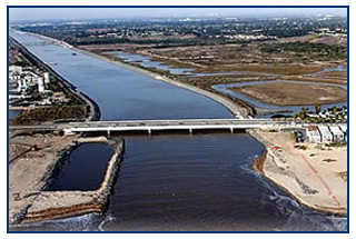
Improvements to 23 miles of existing channel from Weir Canyon Road to the Pacific Ocean include channel widening, improvement to the existing Greenville-Banning Channel located parallel to the river near the coast, relocation of Talbert Channel ocean outlet and construction of rock jetties and derrick stone jetties at the mouth of the river, and bridge modifications to accommodate the widened channel. In the Santa Ana Canyon area upstream of Weir Canyon Road (also known as Reach 9), construction includes bank armoring to protect a mobile home park, residential tract and the 91-freeway.
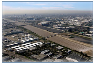
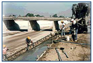
The construction in the Santa Ana Canyon Area also includes bank protection on the south side along the SR-91(upstream of SAVI Ranch) and on the north side upstream of Weir Canyon Road to protect business establishments along La Palma Ave and the BNSF Bridge,. The construction includes several phases that have been completed (Phase 1, 2A, 2B, 3) and ongoing (Phase 4, 5A, 5B, and BNSF Bridge Protection). The improvements include sheet pile and grouted stone bank protection, and bridge pier protection.
Lower Santa Ana River Project Features
- Improve 23 mile channel from Prado Dam to the Pacific Ocean
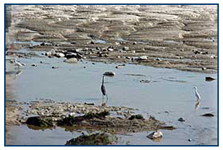
- Restore/Enhance 92 acre (8-acre mitigation) wetlands
- Estimated Cost: $748 million
- Acquire 1,123 acres of canyon lands to ensure safe releases from Prado Dam and provide open space habitat
- Relocate 60 various utility lines and 15 oil wells/lines
- Modify 37 bridges
- Landscaping and esthetic treatment
- Habitat Management Plan
- Relocation of the Santa Ana Regional Interceptor Line
- Status: 95% complete; estimate completion of all final phases in 2020